An island map
Oh, ye'll tak' the high road, and I'll tak' the low road,
And I'll be in Scotland afore ye;
But me and my true love will never meet again
On the bonnie, bonnie banks o' Loch Lomond.
The words of a very famous song, the identity of the author is long lost in the mist of time. As is its meaning.
It might have been written by a soldier, waiting for death at the hands of the enemy.
Or more popular is the version that it was written by a soldier returning north after the defeat of Bonnie Prince Charlie’s troops in the 1745 rebellion. Or it could refer to the Celtic belief that if you die away from home, the faeries will take you back via the 'low road', some kind of transport friendly underworld. Or it be that the high road means ‘hanging by the neck until dead’, the low road means ‘by foot’ i.e. the faithful will get home before the traitor.
The banks of Loch Lomond are indeed bonnie. The loch has many islands, about 60 in low water and about 20 at high water. With that lot on a loch 18 miles long and 4 miles wide you’d think I’d find one suitable for my new book.
But alas not, so I invented one.
The islands are dotted with religious buildings, follies, old ruins and castles and in my case, some dead bodies. There are also a fair amount of crannogs (also found in Scandanavia) where ancient types also had difficulty finding an island to suit them so they built some. Probably some ancestor of Ikea. One upright stake sunk deep into the loch bed, then stones piled round it until it breaks the surface and hey presto - your own island. They were used as homes, status symbols, refuges, hunting and fishing stations. They date back 5000 years, some of them were still in use in the mid 1700s.

A member of the Moray Club took this picture, he blinked and the deer was gone.
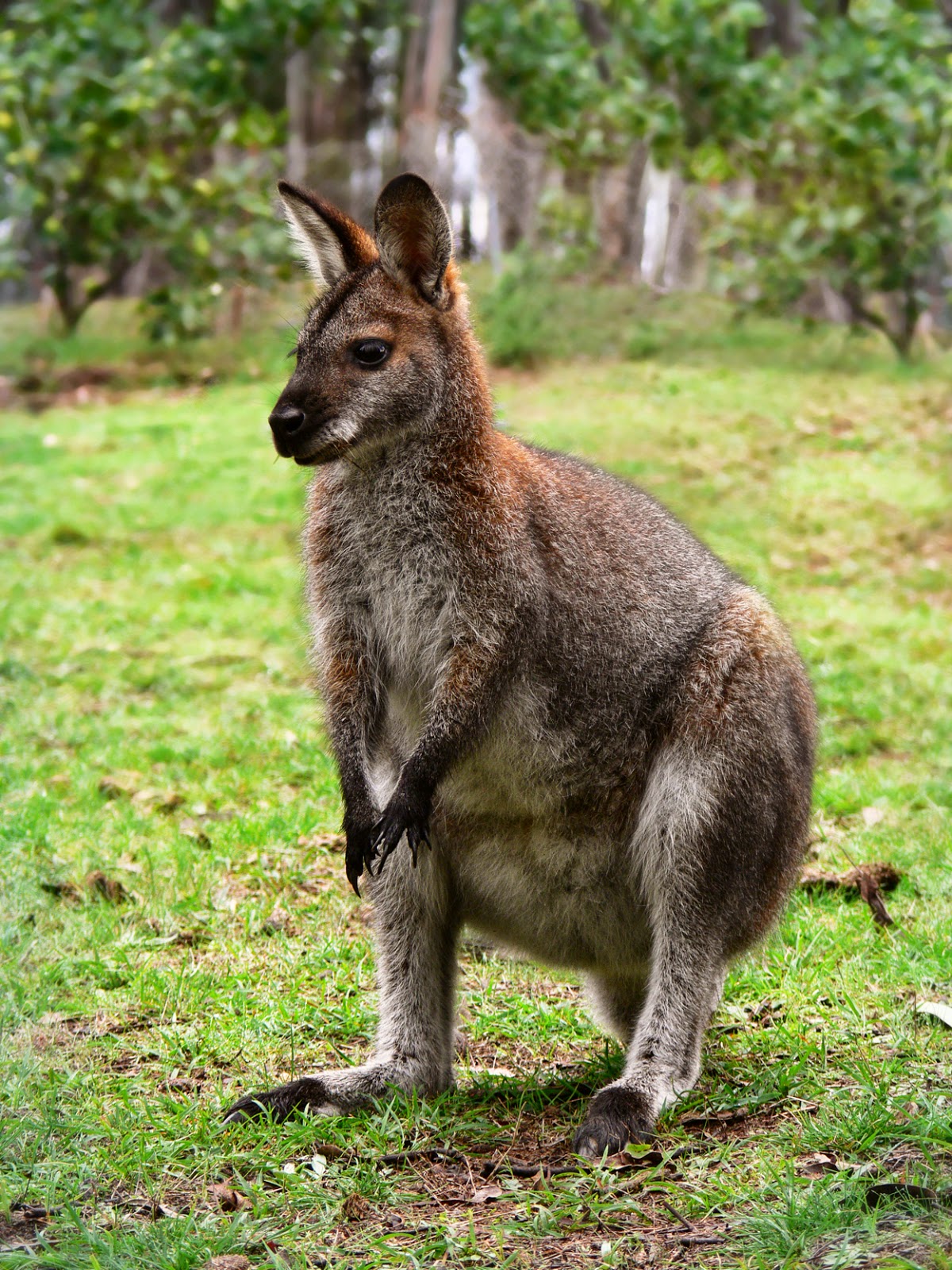
As well as the famous wallabies, there are white deer that swim the loch looking very ghostly and rather magnificent.
Here’s a run through of the islands -
Bucinch (island of goats)
Has no goats.
Clairinch
Used to be owned by the Earl of Lennox. In 1225 he gave it to his clerk ( a Buchanan ) for an annual rent of a pound of wax. The Buchanan’s became a very powerful family from this small start. This island has it’s own wee crannog, Keppinch or The Kitchen.
Ellanderroch (island of Oaks)
Has oaks. Very big ones, for a small island. One oak was weakened by a big hollow in the trunk so the locals filled it with concrete. It was then struck by lightning leaving only the concrete. The loch has many squalls and this is the Island the fisherman head for safety.
Fraoch Island (Heather island)
Covered in heather. Only 150 metres long and 12 metres high. Has little soil to it dries quickly and autumn appears here a month before anywhere else on the loch. A 1792 map shows the island as a prison. It is also said to have been used as a deposition site for nagging wives.
Inchcailloch The island of the woman
The woman being St Kentigerna. This is the most accessible of Loch Lomond’s islands. In the 13th century a church was built in her memory and the Buchanan family used to row across for their Sunday worship. The church was abandoned in 1670 but the graveyard was used until 1947.
Inchconnachan (Colquhoun's Island)
Although no real evidence of occupation remains, there are signs of a grain drying kiln and rumours abound of an illicit still closeby. This is the island of the walllabys. Rarely seen but the place is covered in their droppings seemingly. Or are the sightings of Australian wildlife and the production illegal hooch somehow related....
Inchcruin (Round Island)
Inchcruin has a couple of sandy beaches but is mostly rocky. At low tide it touches Inchmoan island at a strait called ‘the geggles’. Previous owners kept a ex-US army truck on the island. Handy as there are no roads.
Inchfad (the Long Island.)
Boasts its own canal. The canal gave access to a (legal ) distillery on the island. The grass is rich here and is thought to sustain the white deer.
Inchgalbraith
Miniscule. About 25 feet high. Probably an overgrown crannog. The surface is covered by the remains of a castle built by the Galbraiths of Glen Fruin.
Inchlonaig (Yew tree Island)
Has Yew Trees! They were planted by Robert The Bruce. His army used up all the previous ones, using the yew for the bows of his archers
.
Inchmoan (peat island)
Locals used this island as a source of peat obviously. Has some splendid ruins. Swimming here is relatively safe ( but never warm), but the interior is impassible due to gorse and rhodedendrons.
Inchmurrin (St Murrin's island)
The largest island, 1½ miles long, 300 ft high. St Mirren, the saint not the football team, is said to have had a chapel here but no remains have ever been found. Inchmurrin was renowned for its whisky until the exciseman got a boat and put a stop to all the fun.
Inchtavannach (Island of Monks)
Monks, not monkeys. ( some people have misheard it) At Ton-Na-Clag the monks used to toll their bells to call the faithful to worship.
Isle of Inveruglass
'Island of the Black Stream', the Clan MacFarlane had a nice castle on the east side. Oliver Cromwell destroyed it.
Tarbet Isle (Isle of the Portage)
Tarbert is a Gaelic word meaning, literally 'to carry over' or 'portage'. Here it refers to boats being dragged over a narrow strip of land. In this case the land lies between the north ends of Loch Long and Loch Lomond where the Viking King Haakon's men dragged their longboats across to get access to Loch Lomond where they caused havoc. Sweet justice was forthcoming as they lost ten ships in a storm on Loch Fyne, as they sailed to join Haakon’s fleet at the Battle of Largs.
The loch and its islands are in the top ten of the greatest natural wonders in Britain.
English writer, H.V. Morton wrote:
What a large part of Loch Lomond's beauty is due to its islands, those beautiful green tangled islands, that lie like jewels upon on its surface.
I'm away now to design my own island, with an illegal still, monkeys, duck billed platypuses and ....sunshine
Caro Ramsay


.jpg)


